What is Solar Cycle 25? What It Means for GNSS

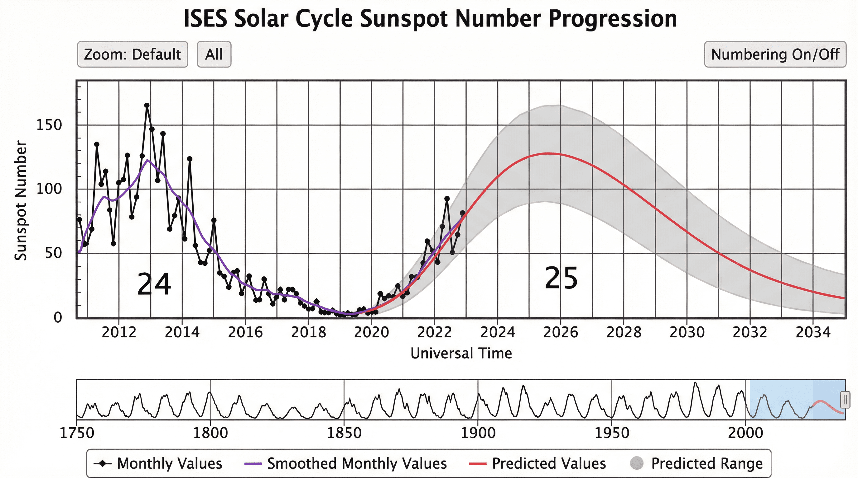
A solar cycle is a period of high solar activity, happening every 11 years when the sun's magnetic pole flips. Solar Cycle 25 is the 25th cycle that is recorded since 1755. It is, coincidentally, expected to peak in 2025 when the sun's activity will reach its maximum.
How Solar Cycle 25 affect my GNSS receiver?
During the peak of a solar cycle, there will be an increase in solar activities such as sunspots, solar flares, and coronal mass ejections. This will affect our ionosphere by increasing its total electron count, impacting all high frequency radio communications from space such as GNSS.
On the rover side, this could mean that it will experience a higher rate of cycle slips or loss satellite tracking all together. As a result, it may take a longer time to secure a fixed solution, reduce position fix stability and lower solution quality.
What can I do to mitigate the affects of Solar Cycle 25?
There are multiple ways that you can mitigate the effects of Solar Cycle 25.
The most effective method in mitigating the affect of Solar Cycle 25 is ensure that you know the ionospheric activity and plan your work accordingly. Although most of the activities generally happens in the afternoon and dusk, this is not always the case. Since most of the solar flare events last from a few minutes to hours, it is possible to plan your work according to the space weather prediction. Trimble provides a great GNSS Planning Tool which can predict for the space weather three days in advance
Where possible, use as many GNSS constellations and frequencies as possible, including GPS, GLONASS, Galileo, BeiDou, and QZSS. This will increase the number and diversity of observations available to assist with the processing algorithm.
Ensure that you have the latest firmware installed on all your GNSS sensors to achieve the best GNSS tracking and positioning performance. A lot of GNSS manufacturers have released new signal processing algorithms which aim to tackle the increase in errors caused by the ionosphere.
If you are using the correction from L-band satellites, where available, it may be better to switch to an internet-based correction source, such as Mondo Pin. This greatly reduces your risk from atmospheric interference of the correction source.
The satellites closer to the horizon will be more impacted by the ionospheric error. Therefore, it is possible to mitigate this error by ensuring that the default elevation cut-off angle is set to 10° or higher.
If you have any further questions, please do not hesitate to Contact us.

